Understand the project
How could a data center affect you?
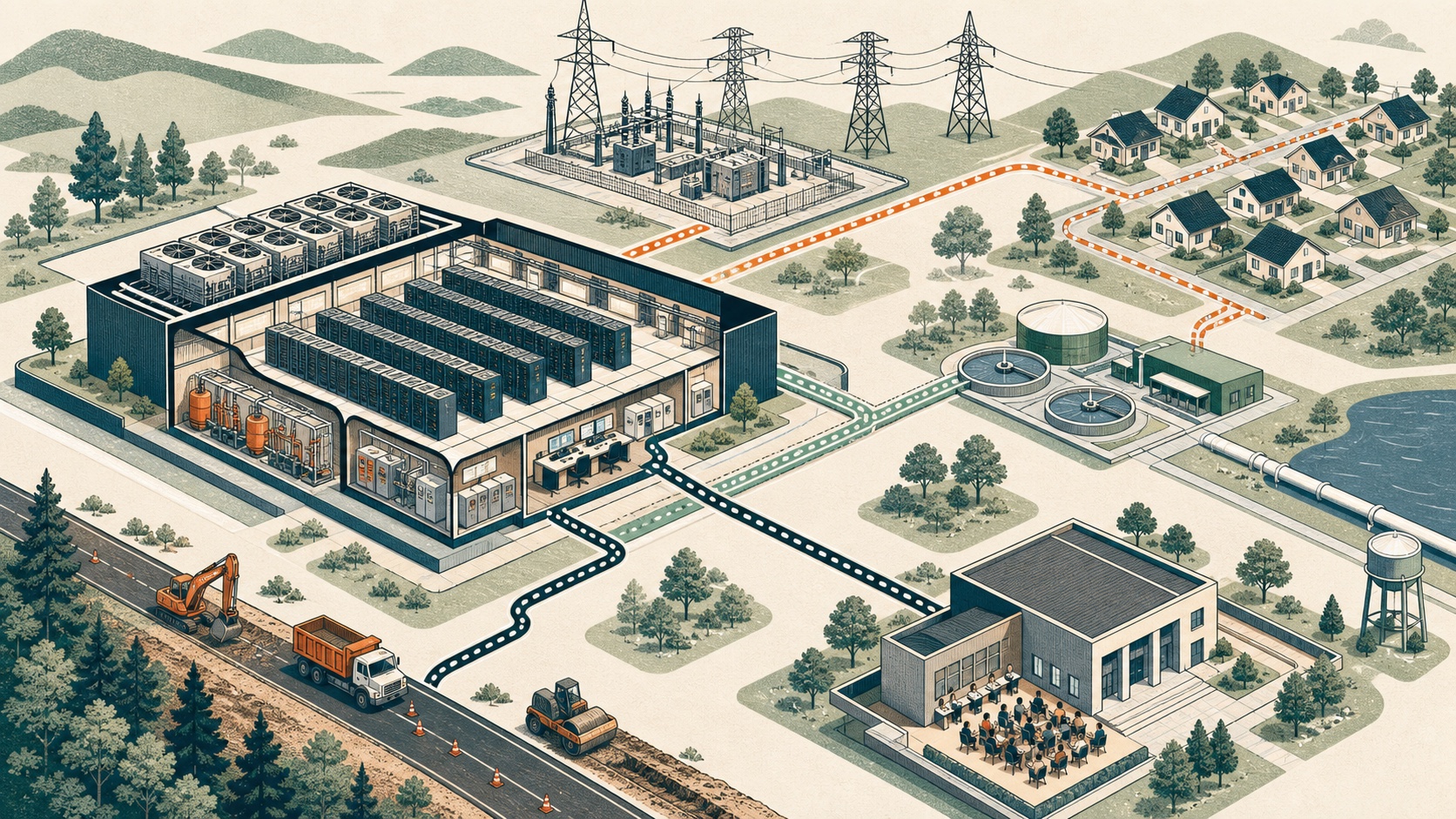
There is no single impact radius. The useful questions follow different systems: the property line, roads, watershed, electric grid, tax district, and public approval record.
Power and electric bills
Find the requested load, new generation and transmission, special tariffs, cost-allocation rules, and protections if a project changes course.
Water and cooling
Ask where water comes from, how the cooling design works, what peak-day use looks like, where discharge goes, and what happens during drought.
Noise and backup generation
Follow sound modeling, nighttime property-line limits, low-frequency measurement, generator testing, complaint response, and enforcement.
Construction traffic and roads
Look for haul routes, peak truck counts, school and emergency conflicts, road upgrades, crash reporting, and a named enforcement contact.
Taxes, incentives, and jobs
Separate state exemptions from local property-tax terms, and separate projections from binding job, revenue, reporting, and clawback requirements.
Homes, farms, and property values
Understand why broad studies cannot predict one parcel, then focus on the siting, buffers, visibility, sound, traffic, and comparable sales that matter locally.
Where the geography really is
- At the site: zoning, setbacks, buffers, stormwater, wetlands, emergency access, and decommissioning.
- Along a route: construction traffic, road wear, school-bus conflicts, bridge limits, and emergency response.
- Across a watershed: withdrawals, treatment capacity, discharge, groundwater, drought conditions, and downstream effects.
- Across a utility system: generation, transmission, substations, fuel, reliability, tariffs, and customer cost allocation.
- Across a tax district: exemptions, payments, school revenue, service costs, jobs, and long-term enforcement.
That is why the project map does not draw a generic circle around every pin. A circle would imply evidence the record usually does not contain. When an agency publishes a real noise contour, truck route, watershed, parcel, or utility territory, that specific layer can be added.
Turn a concern into a checkable question
“Will this raise my bill?” becomes “What is the requested peak load, what new facilities are required, and which tariff assigns those costs?” “Will it be loud?” becomes “What is the modeled nighttime level at the nearest home, how is low-frequency sound measured, and what happens after a violation?” Concrete questions are easier to put into a permit, docket, meeting record, or records request.